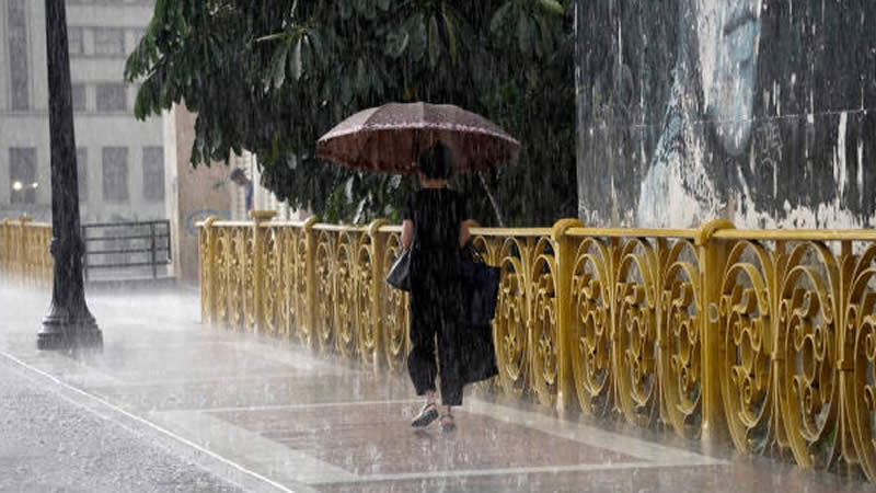
Weather Warning: UK Braced for Storms and Hail After 50-Year Spring Heat Record
The UK’s warm spell has taken a sharp turn as thunderstorms and the risk of flooding sweep in, just days after the country basked in its hottest spring equinox since 1972. After temperatures reached a toasty 21°C last Thursday, it’s now a very different story – with the Met Office warning of heavy downpours, localised flooding and even a return of frost in some rural areas.
There are currently 21 flood alerts in place across parts of the South West and Midlands, including in the Bourne Valley, Wiltshire, where flood risks are on the rise. In Clarendon, groundwater levels have surged to 70.98 metres – anything over 70 metres means property flooding becomes a real possibility.


The sudden shift in weather has been blamed on an unusual mix of unseasonably warm temperatures and an incoming low-pressure system. Jonathan Vautrey from the Met Office explained that while intense storms are more common in summer, climate change is dragging them forward in the calendar.
“For this time in the year, it is rarer to have such intense storms,” he said. “This is happening because we have had a lot of warm weather of late and temperatures are notably above average for the time of year.”

He added that recent highs of over 20°C have helped trigger these early-season thunderstorms, with added moisture fuelling the stormy conditions. “That sort of heat that we’ve got around at the moment has helped to spark off some of these thunderstorms,” he said.
Vautrey also warned this won’t be a one-off. As the climate warms, we can expect to see more intense storms earlier in the year. “We’re constantly seeing warmer temperatures at earlier points of the year compared to where they normally are,” he added. “These sort of intense summer storms are then increasingly going to happen at more points in the year.”
The warning comes after National Highways had to close sections of the M18 in Yorkshire over the weekend due to flooding from heavy rainfall.


Looking ahead, the Met Office says Sunday will start off cloudy, with some rain in the north and east, though this should ease later in the day. The northwest and southeast can expect a few sunny spells, though showers will start to develop as the day goes on.
Senior operational meteorologist Ellie Glaysnor said the mild temperatures are sticking around – for now. “We are not expecting too much change in the temperatures throughout this week,” she said. But she warned that in clearer spots, some rural areas could still face chilly overnight frosts.